Stage 29 / 33 · Camino Francés · Galicia
Sarria to Portomarín
The stage from Sarria to Portomarín is 22 km, about 6 h on foot, with 370 m of total ascent and 490 m of descent.
| Distance | 22 km |
|---|---|
| Estimated time | 6 h |
| Elevation gain / loss | +370 m / −490 m |
| Difficulty | Moderate |
| Highest point | 670 m |
| Lowest point | 325 m |
| Villages with services | 8: Sarria, Barbadelo, Rente, Morgade, Ferreiros, Mercadoiro, Vilachá, Portomarín |
| Longest stretch without services | 6.6 km |
| Updated |
All stages · Camino Francés · Sarria: what to see and where to stay · Portomarín: what to see and where to stay
Starting in Sarria? Where to get the credential
Reviewed:
We organise it for you: bed, luggage and support Plan my Camino
Travelling as a group? Rooms close together, one quote.
Today on the Camino
Finding where you are…
Next village—
To Portomarín—
You’ve arrived: log the stage
Log stageBeds nearby
Need a taxi or luggage transfer? We’ll arrange it
Where to stay in Portomarín
You pay at the property.
Where to stay in Sarria
A Calexa Sarria nº1
House / apartmentA Leira 116 Cabañas de diseño
House / apartmentApartamento casa Chilin
House / apartmentPilgrim hostels in Portomarín(4)
No reservations: beds go first come, first served. A guaranteed bed every night? Plan your Camino
Elevation profile
400 m600 m800 m ▲ 670 m SarriaPortomarín
Official route and distance by the Xunta de Galicia; elevations from a digital terrain model.
Map
Zoom in to see more places to stay
What you will see on the way
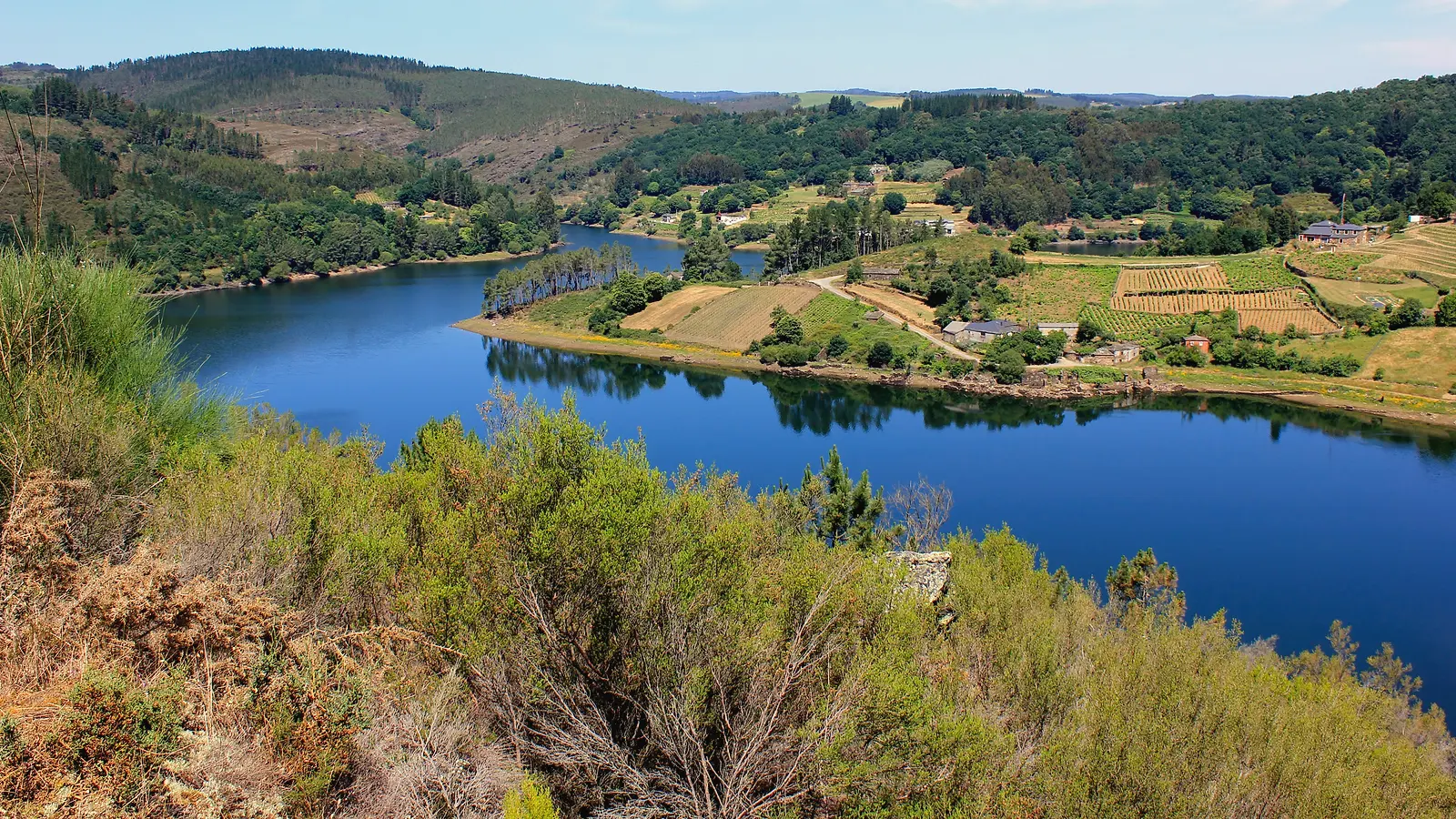
The most walked stage in the world. From Sarria, via the Rúa Maior and the Magdalena steps, you cross the Ponte Áspera and climb among oaks to Barbadelo with its Romanesque church. It is 22 km with 370 m of climbing and 490 m of descent; the high point, 670 m, comes after Morgade, and the finish drops steeply to the reservoir, crossed on a long bridge.
History of Portomarín
Portomarín is a town in Lugo on the river Miño and a stage end on the Camino Francés. In the 1960s, when the Belesar reservoir flooded the old village, a new town was built on Monte do Cristo and its fortress-church of San Nicolás was moved stone by stone.
A whole village lies under the water; up the hill, a church with numbered stones tells how it was saved.
What not to miss in Portomarín
- Church of San Nicolás
- Stairway and Capela das Neves: the classic entrance, on an arch of the old bridge
- Belesar reservoir: ruins visible at low water
Origins and the Camino
A Roman bridge stood here in the 2nd century, and the Codex Calixtinus calls the place “Pons Minea”, the Miño bridge. Queen Urraca had it destroyed in 1112, and around 1120 Pedro Peregrino rebuilt it and founded a pilgrim hospital.
Anecdotes, curiosities and legends
Before the water arrived, the church was taken apart and every block numbered so it could be rebuilt on higher ground. Look closely at the walls: the marks are still there.
When the reservoir runs low, remains of old Portomarín and its medieval bridge reappear.
Pilgrim tip
On Easter Sunday Portomarín holds its aguardiente (grape spirit) festival; the rest of the year, ask for the local aguardiente after dinner.
Villages along the way
| Village | km | Altitude | Services |
|---|---|---|---|
| Sarria · Places to stay | 0 | 450 m | BarShopPharmacyATMDoctorWater fountain |
| Barbadelo | 4.5 | 560 m | BarWater fountain |
| Rente | 5.5 | 590 m | Water fountain |
| Morgade | 12.1 | 640 m | BarWater fountain |
| Ferreiros | 13.3 | 650 m | Bar |
| Mercadoiro | 16.5 | 560 m | Bar |
| Vilachá | 20.1 | 470 m | Water fountain |
| Portomarín · Places to stay | 22 | 350 m | BarShopPharmacyATMDoctorWater fountain |
© OpenStreetMap
Related guides
Self-guided Camino tour from Sarria
Your Camino organized, nothing to worry about
Free, no obligation · Reply within 24 h
Xacobeo 2027 Holy Year: dates and when to book
Do you run a business on this stage?Advertise here